Storms Return to the Area Monday Afternoon for the First Time This Spring
While it will still be warm, Monday will feature increasing clouds with showers and storms by mid to late afternoon, lasting into the evening.

A cold front will be dropping south today, while an upper level disturbance moves in from the west. The end result will be to put the “squeeze play” on the warm weather we’ve enjoyed since Sunday.
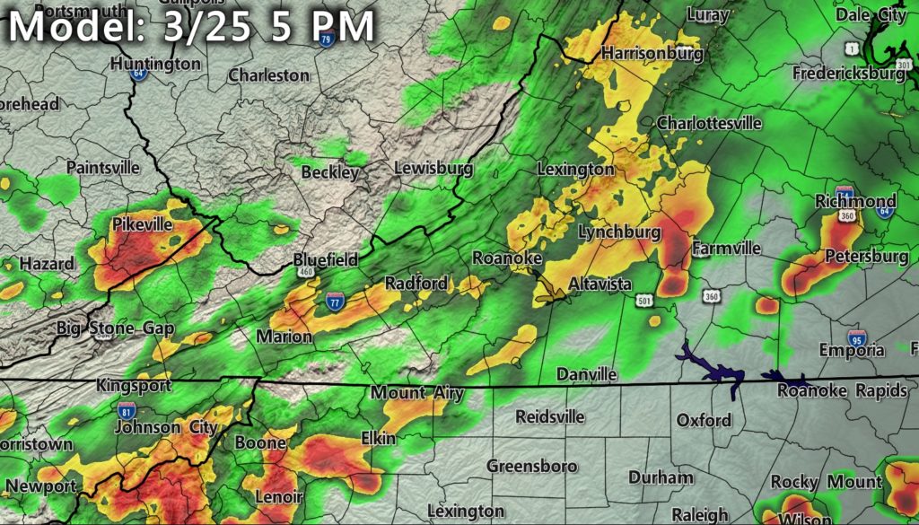
I’ll be watching the amount of cloud cover ahead of the system today, because it will determine whether or not we just see rain, or get our first day of heavy storms late this afternoon. If we manage to warm up into the middle 60’s – which will happen with any breaks in the clouds – there is a better chance of storms forming.
The best chance for storms will be after 4 p.m. Areas east of the Blue Ridge have the highest chance. Everyone should see at least some rain, regardless of storms. Generally, amounts of .25″ to .50″ are expected, though the scattered nature of storms can lead to tricky precipitation amount forecasts. As we get further into the warm season, “overall” rainfall amounts become somewhat irrelevant as storms are either a hit-or-miss phenomenon.
The storm system moving through today will have limited surface moisture and heat to work with, but it will have decent lift and energy aloft along with cold air aloft.
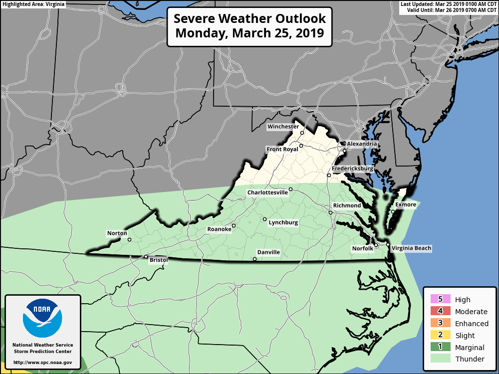
The Storm Prediction Center only has general thunderstorms in their outlook for us today. One or two storms could have gusty winds and heavy downpours, but severe weather may be hard to come by with limited sunshine and warmth. I can’t rule out a strong storm, though, especially in warmer spots that see more sun ahead of the rain.
Lingering low clouds, drizzle and fog are expected overnight as cooler air undercuts the moisture. We will clear out from north to south Tuesday morning with afternoon sunshine. Temperatures will be cooler – only around 50 – for highs. We warm back up and stay sunny through Friday with highs near 70 again by the weekend. Today’s rain will be the only decent shot of moisture we’ll have this week.