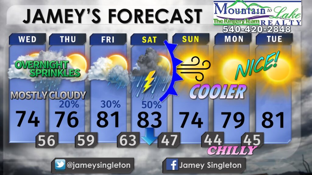
9/4/24 – INCREASING CLOUDS WITH SPRINKLES WEDNESDAY NIGHT, TEMPS STAY IN THE MID TO UPPER 70’S…
East winds underneath high pressure to our north will keep us from getting too warm Wednesday and Thursday. Most of the deeper moisture is going to stay south of our area, but we will see some jet-stream level cloudiness moving through during the day Wednesday with added low level moisture pooling up against the Blue Ridge Wednesday night, burning off a little for Thursday. That means limited sunshine but any rain will be limited as well. Still I think a few scattered sprinkles are possible Wednesdsay night.
Things clear out and warm up a little for Friday.
Our next big weather maker will be an approaching cold front on the way for the start of the weekend. Ahead of the front, I’m carrying a 30% chance of a few scattered showers Friday evening into Friday night with the best chance of showers and storms Saturday along the front itself, as it moves from west to east.
The timing of the front is sus. Right now it looks like the front may move through in the morning on Saturday, which could allow us to clear out by mid to late afternoon Saturday. But that’s not set in stone. Fronts tend to slow down this time of the year, so I’m not going to be too detailed with timing of rain yet for Saturday. It won’t be all day, however. I’m expecting about 2-4 hours of showers and storms just ahead of the front, whenever it moves through Saturday.
Temperatures will fall sharply behind the cold front Saturday evening and Saturday night, leaving us with breezy, fall-like air for Sunday with highs only in the lower 70’s.
But the dose of cooler air is just an early sample of Fall. While overnight lows stay chilly in the 40’s due to clear skies and dry air, daytime highs will moderate thanks to the high sun angle working on that dry air, allowing us to warm into the lower 80’s again by next Tuesday.
I have more on my Patreon Page at patreon.com/jameysingleton

