Clipper Brings Accumulating Wet Snow to the Area Friday


By: Meteorologist Jamey Singleton
FRANKLIN CO. – In what may very well be Winter’s last gasp for the area, a strong clipper may white the ground in many areas Friday.
A Winter Weather Advisory has been issued from the National Weather Service for the Roanoke Valley and westward into the Highlands and Greenbrier Valley from midnight to 7 p.m. Friday.
As of Thursday night, snow has already fallen in far SW Virginia, from Grayson County into Wytheville and Richlands. Snow will continue to develop in a spotty and light nature across the mountains late Thursday night into early Friday morning.
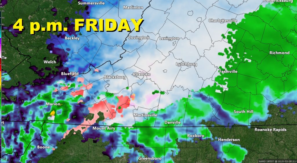
As the heart of the system moves in Friday, a more concentrated area of precipitation is expected to move west to east across the area from mid-morning into mid-afternoon. Most of the moisture will be falling as snow, and within this “burst” of snow, rates could be heavy enough to plop down a quick 1-3” of snow in parts of the area.
Since the New River Valley and Highlands will see the snow start before the March sun rises, the higher 3” accumulations are most likely there. Isolated amounts to 5” aren’t out of the question in the mountains.
Whether or not the higher accumulations can make it east of the mountains depends heavily on the timing of the moisture relative to sunrise. If the snow can start before the sun gets too high in the sky, and fall fast enough so it forms a base, there could be higher totals east of the mountains as well. But that’s questionable right now, as any delay in the precip would result in warmer temperatures, even with cloud cover. Snow lovers would need the falling snow to “lock in” the colder temperatures required for the snow to stick elsewhere.
Watch out for slick spots on the roads, especially in shady and north-facing areas during the morning commute. It is entirely possible for it to be pouring snow at some point during the day Friday, which would certainly create very slick roads for a few hours no matter what the temperature.
The snow moves out by Friday evening, leaving low clouds and dense fog around for Friday night. Clouds linger Saturday, followed by our next system, which will bring rain to the area Saturday evening.
The rain clears the area Sunday, with a taste of Spring for the afternoon as highs near the lower 70’s.