Franklin Co. Public Safety Special Ops Team Returns from Buchanan Co. from Flooding In Time for Ida
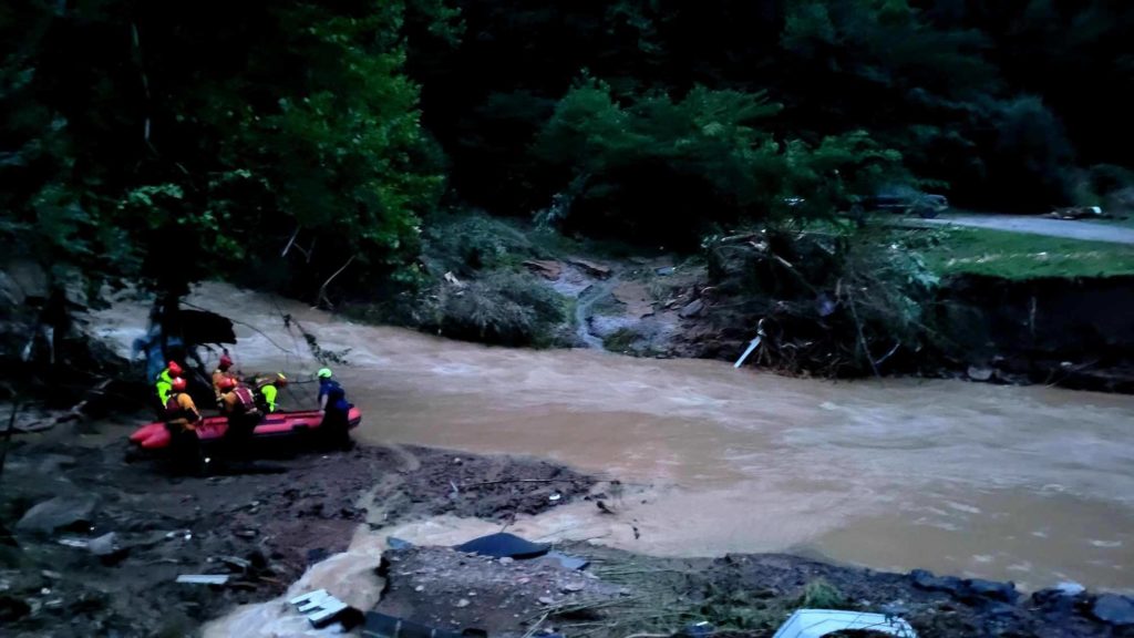
BUCHANAN CO., VA – A cluster of heavy thunderstorms Monday on saturated ground produced major flooding in far Southwest Virginia. Local teams were dispatched to the area and are returning, according to a Tweet by the Franklin County Department of Public Safety.
Crews from Division 6 were dispatched by the Virginia Department of Emergency Management to Buchanan County, including Franklin County Public Safety’s Special Operations Unit. Roanoke County, Salem, and Roanoke City crews were also sent to the area.
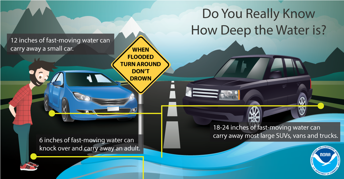
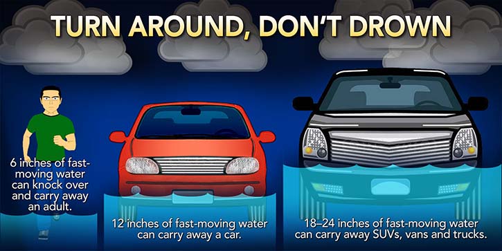
Special operations teams usually handle swift water rescues in extreme flash flood or flooding situations. Many times people drive into floodwaters and are swept downstream in their car because they underestimate the depth of the water or because the road has simply washed away. It only takes a foot of water to float a vehicle and two feet of water to cause the vehicle to float away.
Most flash flood deaths occur in automobiles, according to statistics from the National Weather Service. Inland flooding from heavy rain is a major contributor to rescues and deaths from tropical weather events.
The return back from Buchanan County to Franklin County, Roanoke, and Salem comes just in time for the remnants of Ida. Most of the area is under a Flash Flood Watch, including Roanoke and Franklin Counties through Wednesday evening.
Rain will turn heavy at times overnight into Wednesday morning with embedded storms possibly bringing severe weather and rotation, even possible tornadoes as the system moves through.
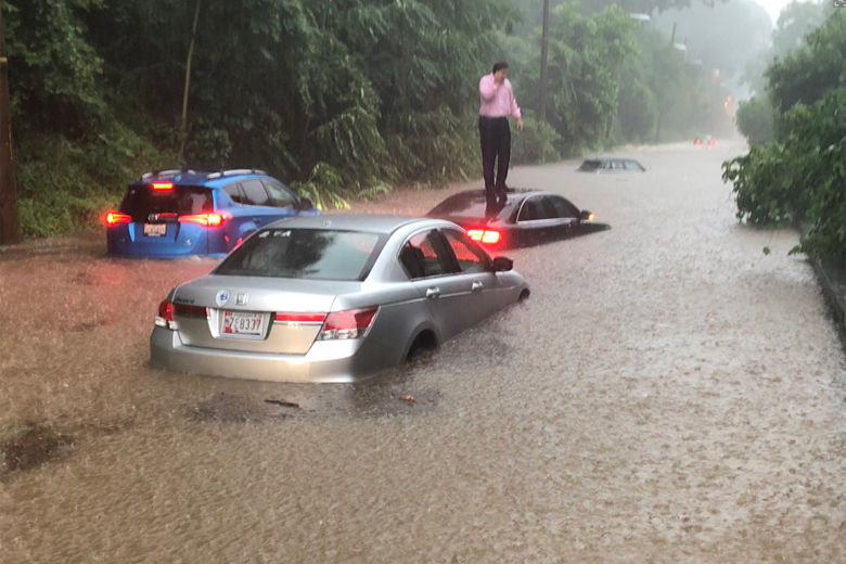
Since tropical systems contain lots of atmospheric water vapor, it’s actually the rainfall rates that can produce the more prolific flooding. In some cases, a band of storms can dump a quick 1-4″ of rain per hour.
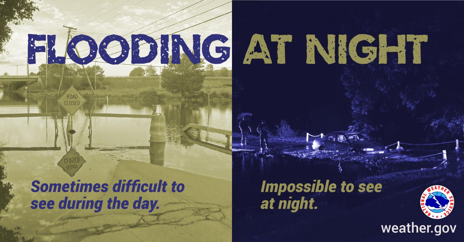
While many deaths occur from people driving into floodwaters, the extreme runoff from high rainfall rates can simply flood roads that were just wet minutes earlier. True flash floods can occur in seconds and are very dangerous.
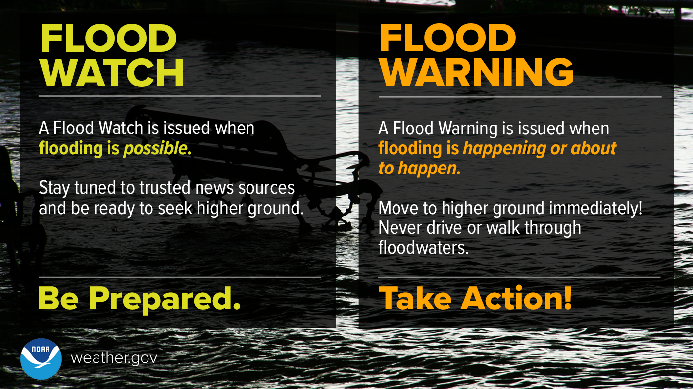
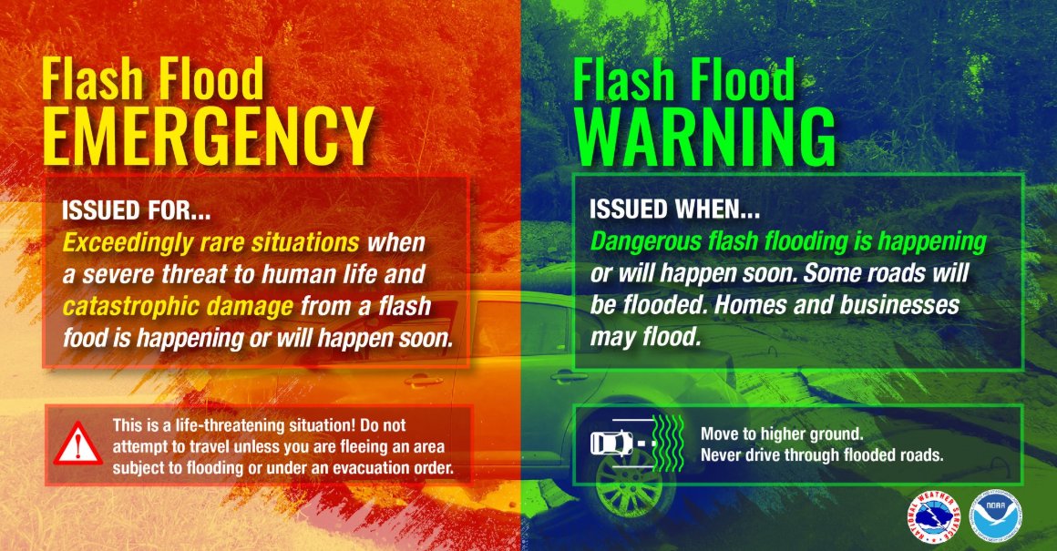
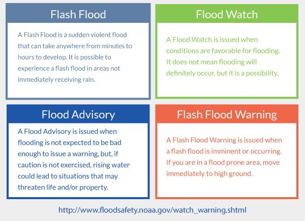
Stay weather-aware tonight and Wednesday! Below are some flash flood and flood safety tips.
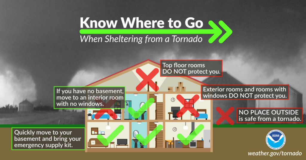
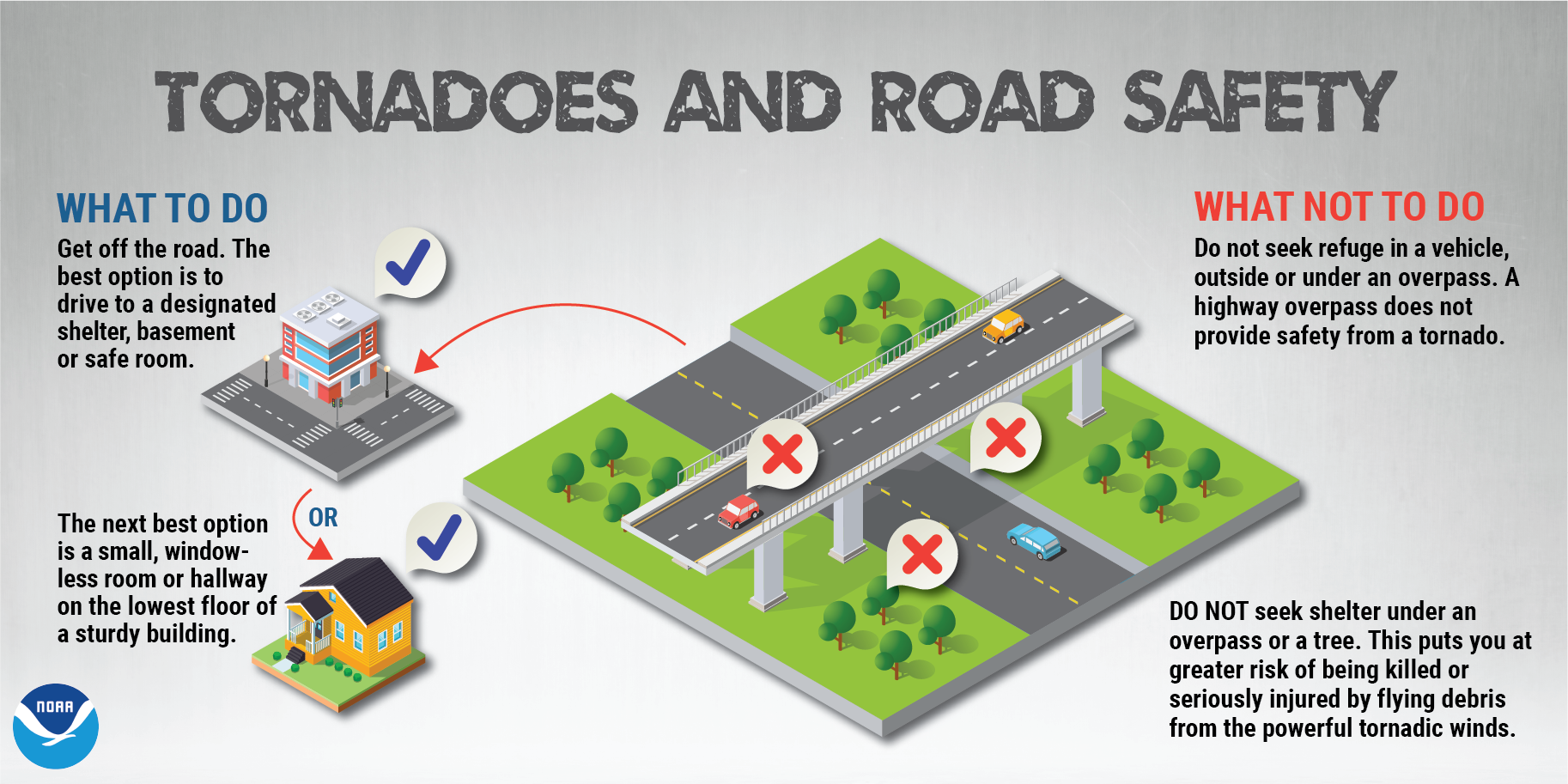
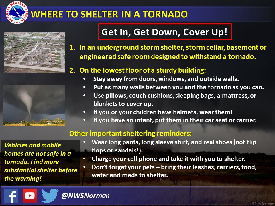
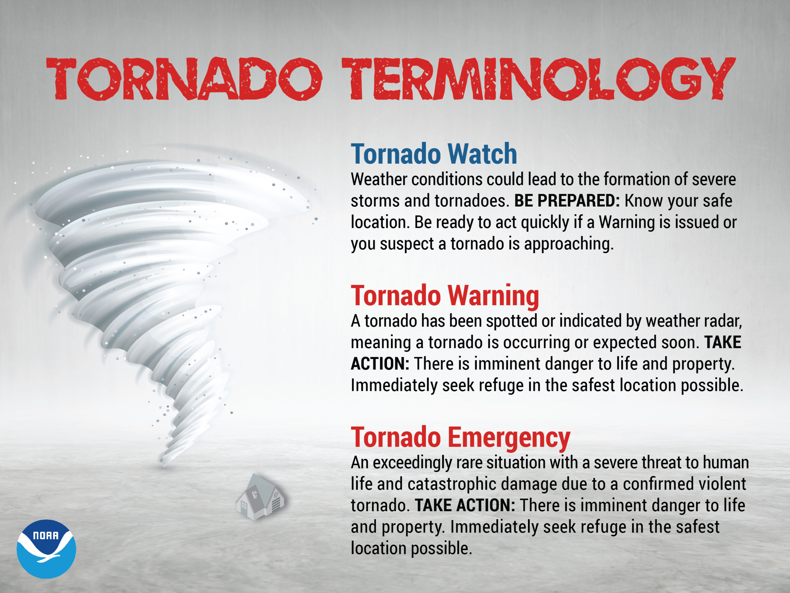
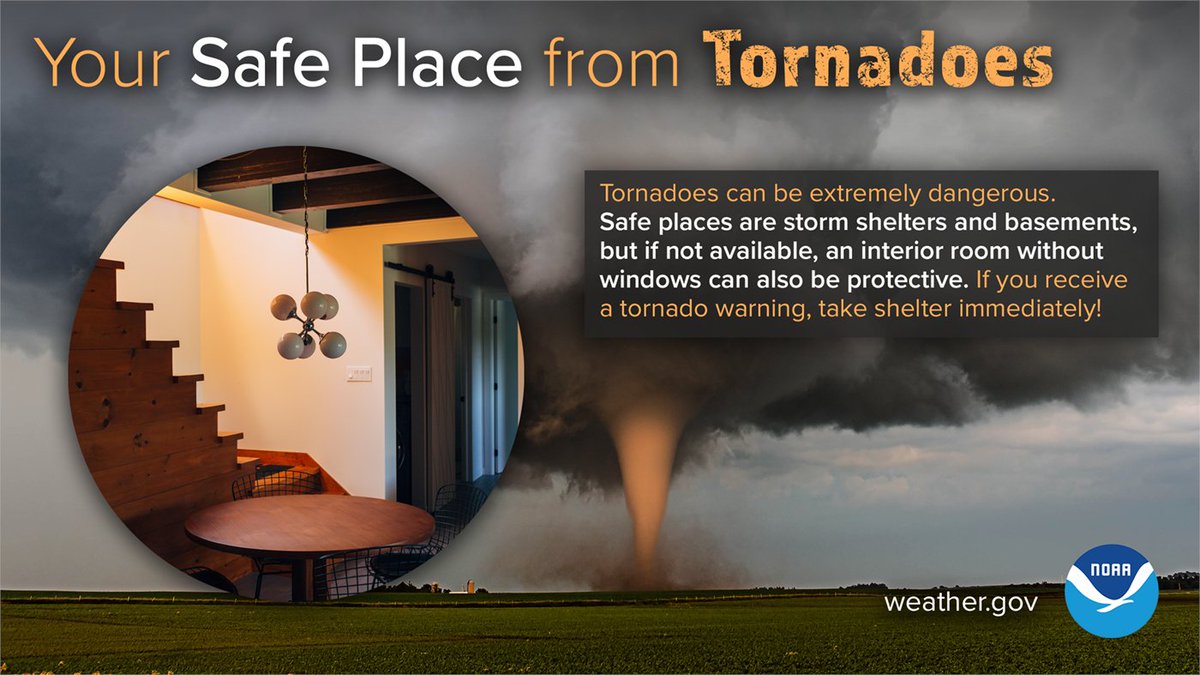
There’s also a chance of tornadoes tonight and Wednesday. Know where your safe place is and be prepared to seek shelter if you are alerted to a Tornado Warning where you live.
Here are some tornado safety tips…
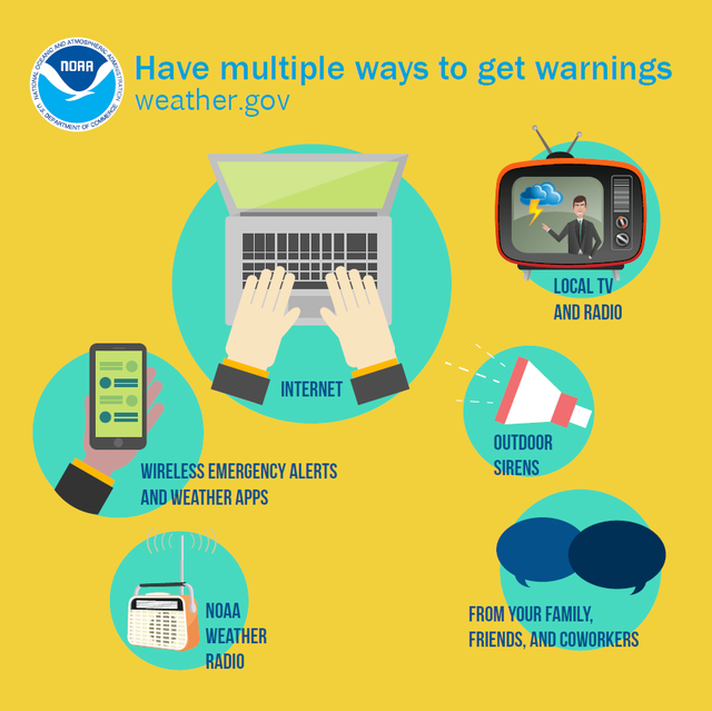
For the most up-to-date information, please follow my social media.
My Twitter feed automatically posts within seconds any alerts for the area from three different sources, not counting what I send out myself. It’s a great source to know exactly what’s happening in the moment. You can click or tap on the bell alarm on my profile and be notified with each tweet.
My Patreon Page is a $1/month blog that shows higher resolution model images and exclusive information that sheds more light on my forecast process. The money is used to pay for the weather data I pay out of pocket for each month.
My TikTok page covers the entire country with LIVE videos from my weather office, even outside of our local area.
https://www.tiktok.com/@jameysingleton12?lang=en
My Instagram Page posts pictures of flooding and storm damage as I get them from followers. I also post infographics to the page.
https://www.instagram.com/meteorologist_jamey_singleton/
My Facebook Page posts my public 7-day forecasts, the most serious alerts and weather updates.